

The Bradley Preserve at Alexanders Ford is 163-acre nature and heritage preserve. The trail is an official certified section of the Overmountain Victory
National Historic Trail.
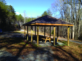
The preserve includes a picnic shelter. The trail is now a loop consisting of an old road bed that leads down to the river and a single track trail coming back. It is a pleasant and peaceful walk in the woods. It is a great place to take the kids and the trail is pet-friendly. The halfway point of the loop is at the Green River.
An old family cemetery has been cleared and open for viewing. It is on the right side of the trail about half-way to the river.
WHERE: Rutherfordton, NC
DIRECTIONS: Located near the intersection of Polk County Line Road South and Gray's Road. From Rutherfordton, go west on NC 108 until reaching Polk County Line Road. Turn left on Polk County Line Road South and go 1.4 miles to a stop sign at the intersection of Gray's Road and Abrams Moore Road. Go straight towards Gray's Chapel Church. Veer right before the church and follow gravel road to parking area near the small picnic shelter.
Keep your maps in a plastic bag to protect them from the rain and know how to use them. GPS units are great, but they are not substitutes for knowing how to use a map and compass.