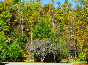


South Mountains State Park features more than 20,000 acres of land with elevations to 3,000 feet, an 80-foot waterfall, mountain streams and more than
47 miles of trails for hikers, equestrians and mountain bikers. It borders the South Mountains Gamelands.
Parts of this park are very remote and give a real sense of being away from it all! When combined with the gamelands, there are close to 50,000 acres of
public land in this area. There a number of backcountry campsites.
This is the best place in the area for equestrians and includes an equestrian campground. Most of the park’s trails are open to horses with a total of
33 miles available. Here is a map of the trails open to equestrians and recommended loops.
Not all of the trails are open to mountain bikes, but there is still a challenging 18-mile loop open to mountain bikers.
There are now two sections of the park. The main park section (Jacob Fork Access) is south of Morganton off Hwy 18. The majority of the parks open trails
and amentities are in this section.
The new Clear Creek Access is located off US 64 between Rutherfordton and Morganton. It currently has a lake and one trail along a creek. It is slated
for additional improvements in coming years.
For more info visit the park’s website at this address:
https://www.ncparks.gov/south-mountains-state-park
WHERE: Morganton & Connelly Springs
DIRECTIONS: Main Park (Jacob Fork Access) - 3001 South Mountain Park Ave., Connelly Springs, NC 28612 Clear Creek Access - 5999 Branstrom Orchard St., Morganton, NC 28655 (off US 64 between Rutherfordton and Morganton)
Keep your maps in a plastic bag to protect them from the rain and know how to use them. GPS units are great, but they are not substitutes for knowing how to use a map and compass.