


The Paddle Trail consists of 12 Sections in Rutherford and Cleveland Counties starting below Lake Lure. There are two sections on the Rocky Broad River above Lake Lure:
WHERE: Rutherford and Cleveland County, NC
DIRECTIONS: See Individual Sections
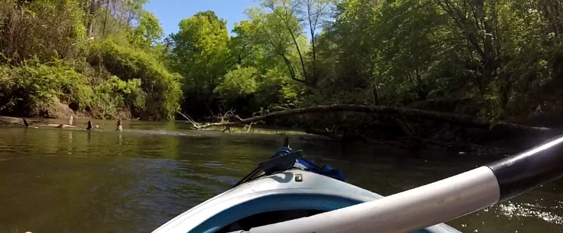
I floated section 4 of the Broad River on Friday, April 24th. The section is passable, but at 2.8 miles in, there is a large tree down and you will need to go slow as you go under it. At 4.3 miles in, there are a couple of trees down and you can get by through a small path through the middle. The water level was about a foot higher than normal on this day, and these areas I mentioned may be easier to pass through at normal water levels.
I floated section 5 on Saturday, May 9th, and there were no complete blockages to report. At 2.7 miles in, there is a large pile of brush blocking most of the river, but you can go under a tree on the far right to get past it. It was a nice, 5 mile float and I recommend this section for all skill levels. There is small drop in the river about a mile from the end, but it pretty easy to float over. There is a large rock to the right that you can use to portage around it if you do not want to float over it, though.
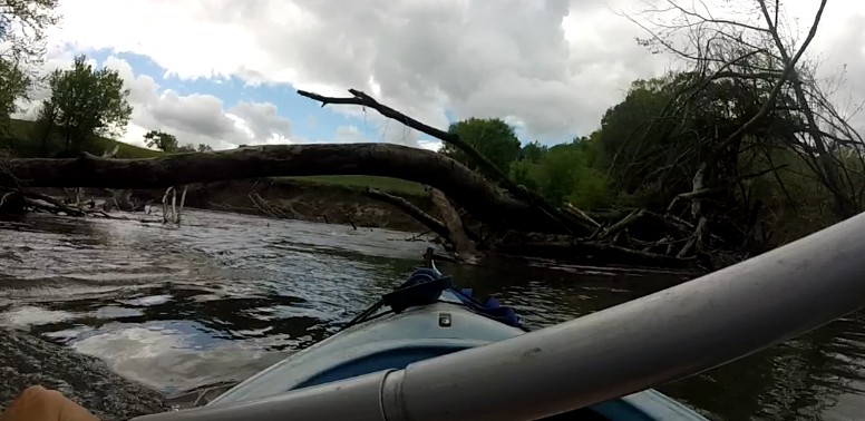
We scouted sections 4 and 5 of the Broad River on Wednesday and found several trees that are down and blocking most of the river. On section 4 (River Road to Grays Road), there are four areas where trees are blocking most of the river and you will have to use caution to maneuver through. On section 5 (Gray's Road to Coxe Road), there are three areas where you will have to go slow and two of those require you to go through some branches to get through. The 1st picture is Section 4 (River Road to Grays Road): At 2.2 miles in, there is a tree down all the way across the river, but you can pass by going all the way to the left side.This picture was taken from the other side looking back up the river. The 2nd picture is Section 4 (River Road to Grays Road): at 2.8 miles in, you will have to go very slow and work your way around a small tree and under another to get through. Our river stewards and volunteers will try to clear some of these areas as soon as possible. Let us know if you would be interested in helping.

Make sure you have the supplies to deal with major injuries, and make sure you have the knowledge to use it.


 View Image(s)/Video(s)